New Taggr
A new release of the Taggr application takes it to v0.22. Minor changes include fitting it into a 1024x768 window and promoting the 'See this location in the Viewr' link. Taggr v0.22.
Comments welcome as ever.
A new release of the Taggr application takes it to v0.22. Minor changes include fitting it into a 1024x768 window and promoting the 'See this location in the Viewr' link. Taggr v0.22.
Comments welcome as ever.
- Accelerometer sensor in N95 = radio control car controller!
here
- N95 as light sabre using accelerometers
here
- The 'Pointers' group on Flickr
here
- The Flickr Pointers Pool
here
- The relatively rubbish Flickr Map of the Pointers Pool
here
- Tracking fingers with a Wii remote -- not wholly related, but cute.
here
- GMiF = an add on for mozilla = the real taggr?
here
- EARTHMINE - a video - pasted from here!
- OS maps available in API from Jan 08...
here
- OpenSpace from OS website...
here
- MapThis! app for map display + GPS on PSP
here
you tube video...
- OpenStreetMap Tiles in VRML (not new!)
here
- OpenStreetMap API Spec (not new!)
here
- Google Map Blog - Confessions of a Search Box (hijacked all Flickr images for pointers!)
here
- Flickr stats.
here
- GPS for the IPhone - coming February 2008 for $89.
here
- a navigation device without a screen! Haptic innit!
here
Go on! Give your photos a point! It's not hard and it'll make them far more useful and interesting to view.
Currently there are a large number of mapped photos in flickr
- More than 30,320,000 are geotagged... but ...
- 8,215 have a geo:dir
- 3,419 have a ge:head/ge:heading
- 26 have a kml:heading
- 10 have a geo:heading
- 0 have a kml:dir, quakr:compass or exif:GPSImgDirection (at least that's what the searchers tells me)
That's such a huge minority, we decided to make it all easier for you...
As of α0.38, the Quakr Viewr now supports point!
simply add
point=[[north, northnortheast, northeast, eastnortheast, east, eastsoutheast, southeast, southsoutheast, south, southsouthwest, southwest, westsouthwest, west, westnorthwest, northwest, northnorthwest]] or
point=[[n, nne, ne, ene, e, ese, se, sse, s, ssw, sw, wsw, w, wnw, nw, nnw]] or
point=[[0...359]]
and the greasemonkey flickr script will understand and add the link to the Viewr to your Flickr image page and we'll include your images in the generated world.
See http://www.flickr.com/photos/hardbutnot/1534749879/in/set-72157602245100210/
as a simple example from flickr ... and in the viewr here.
Comments as ever welcome...
- How to become a tagging master!
here
- How much is a 3d model worth?
Roger Rayle has used Google Earth to visualise (pall Gelam) Dioxane Levels/Plume maps and Aquifer locations, of note the system is used not just as a communication tool but also as a decision making system. The data is visualised over time providing a genuinely impressive implementation of the technology developed for the Society of Residents for Safe Water.
Rogers notes that a picture is worth 1000 words, a 3D model is equivalent to 10,000 words and if you add in the forth dimension of time its worth 1,000,000 words.
Following some R&R for the last month and a half, the Quakr team have once more returned to work! Released today are two updated αlphα's.
Taggr - the tool to help you tag.
> Now supports GEO:ALT and GE:TILT tag.
> A simpler, clearer help and new look and feel.
> Links to the Viewr.
Viewr - the 3d photo view
> Compass on the ground instead of three lines
> Semi transparent images until selection
> No longer standard 'shabbatagging' - more images displayed in first view
All comments as welcome as ever...
- geoblog post about 3d globes...
here
- google vs Ordinance Survey - there are no winners...
here
- Quakr went to the pub
here
- Viewr alph 0.32 = image info + date taken + tags
here
- A Viewr depiction of how to get from the station to my house...
here
- Quakr talk at UCL Brown Bag, 01.08.2007
here
-- more --
- topography on plates & "what it's like to walk up a hill discussed..."
here
- street view VS everyscape VS mapjack in YouTube form!
here
- George Wolberg and something he calls Photo Sketch.
here, here, here and here
- we've make'd it!
here
- an important aside.
here
- Yahoo tiles get "better".
here and here
- Flickr 20 Million GeoTagged photos.
here
- Virtual Cogs - GPS + Camera + PSP screen?
here
-- more --
- A personal blimp (not wholly related...)
here
- Google starts a SketchUp blog...
here
- Google Campus 3D and other SketchUp content
here
- map the floods
here, here
- moblog - mobile blogging...
here
-- more --
- Flashr - a actionscript wrapper to the Flickr API
here
- Psynchr - used the above to make a timeline of images
here (I tried and failed to get two photosets into it... http://www.flickr.com/photos/katieportwin/sets/72157594490167134/ and http://www.flickr.com/photos/hardbutnot/sets/72157600047520967/ -- hmmm)
- Flappr - entirely flash based flickr viewr...
here (it's a bit old...)
- Google Map blog post "A world built by its inhabitants"
here
- planning? pfflanning...
here
- pileus - an umbrella with lots of stuff...
here
- tech review of a new service - "the flickr 3d"
here
- flickrVision in 3d...
here
Thoroughly enjoyed OpenStreetMap's  conference in Manchester yesterday.
For a start, it stopped raining for about an hour in the afternoon for the first time since I moved here.
Second, as a rambler, I am in love with  . Nick takes take a weekly data dump from openstreetmap, adds a contour map from Nasa, and - best of all - allows annotations on the map, such as "this path is a bit scrambly" and (I envisage) "field on the left contains farmer with shotgun".
Third, I enjoyed seeing that London motorcycle courier timeline GPS traces thing again:
.. but was particularly interested to hear Steve's comment that it wasn't actually as useful as envisaged, since the GPS traces had no accompanying metadata. Hmm, a gratifying point for metadata geeks.
Fourth, Andy Robinson talked about tagging and standardisation. Openstreetmap suffer the same problem as Quakr - synonyms and homonyms, tag soup, emerging taxonomies not emerging in the way you expected - in short, the "horse=yes" problem. Like us, they don't want to impose a standard like GML or prevent users from typing freeform, but like us, want to make some use of tagging metadata and hence could use a little standardisation. Andy had a few suggestions, including:
1. Get people to reuse terms where possible, even if they aren't a perfect fit.
2. Have a Q&A style wiki to facilitate this.
3. Use definitions from the Oxford English Dictionary if in doubt.
4. Use namespaces - Andy is suggesting STAG_BASE: for things like rivers and fields, STAG_BUILT: for buildings, canals, etc, STAG_ADMIN: for road classifications etc.
Although I like namespaces and think they can work for tag data (geo:lat is pretty popular), I'm not completely convinced they'll solve the tag soup problem. Namespaces are good for saying what vocabulary you're using, or disambiguating two keys which belong in two domains, but did we really have two kinds of horse? It's definitely a good way of categorising things though.
And all power to Andy for tackling what to my mind is the most important and interesting problem facing anyone dealing with tagging metadata - that it's a Messy Mungy Business. (See what does 'tilt' mean, anyway?" ![]() )
)
Finally, you just can't beat artwork like this:
Enjoy!

Easy on the woodbines though Peter - we may be banned in California by next week.
Following a hectic June which included moving house, Glastonbury, some photos and our speaking engagement at the Where 2.0 conference, we've been mostly a bit quiet.
However...
*) Due to popular request we've updated the Taggr application to include the newly updated Google Map satellite imagery.
*) We are currently working "hard" on getting some more functionality into the Viewr.
*) We've done some testing on the relatively newly released Sandy v1.2 and it looks oddly slower, but we'll discuss and sort that soon I suspect.
*) Now that the Flickr Query problem we uncovered has been fixed, the whole Viewr experience is much speedier. We're now able to subset the GEO data we get from Flickr to only include those with the minimum tag set on the first query rather than having to mess with the whole pile ourselves.

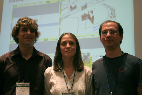
So. I talked. People seemed to listen (although it was fairly hard to look into the eyes of 800ish people in a huge ballroom) and then asked sensible questions of me after it. I would have said that 24 hours worth of travel for 15 minutes of talking was some poor economics, but the geekworking potential proved irresistible. It was really good to meet the organisational wizzo and his various helpers, re-acquaint myself with Schuyler Erle and the good folks from Loki, and meet up with variously interested and interesting people.

- Google Earth does the Tour De France
here
- KML into GMaps = my photos on Gmap?
here
- PPT version of the XTech Presentation
here (16Mb)
- PPT version of the Where 2.0 Presentation
here (11Mb)
- Ask turns into Ask 3D
here
- JetBlue photo's from planes
here
-- more --
- BBC using Photosynth fore Britain collection
here
- same story on Guardian Unlimited
here
- Eye-film = SDRAM with Wifi = always connected camera = GPD in EXIF?
here
- read in a Wii remote's accelerometer information...
here
-- more --
- eye-fi gets $5.5M funding
here or here
-- more --
- "kinda like Google Earth as a flash app in the browser"
here
- "found from Quakr Viewr"
here
- a video on photosynth and how it relates to us
here
- to patent or not to patent - that is the question this paper answers
here
-- more --
- a review of geovector from this time last year
here
- interesting London Uni research sites
here, here and here
- google gets better images of the UK
here
- google zoomed in satellite imagery of Oxford
here
- LORP - sightseeing his Rome set
here
- journal about where in Japanese mentions us
here
- sandy 1.2 released
here
-- more --
- google picassa web albums get maps and mobile
here
- google gadget cash likened to facebook widgets?
here
- digital urban - a blog of interest...
here
- everyscape - better than google streetview?
here and here
- earthmine - many many Quicktime VR's with tags?
here
- 4d flythrough - i.e. 3D + Time - interesting researcher
here
- PC World article about GPSing your photos
here

"Phew!", we thought.
We had made it through XTech fine and there was some genuine interest in Quakr.
"Onwards and upwards", we thought.
Then Brady Forrest at O'Reilly got in touch out of the blue to say this:
> Howdy,
>
> I am the Chair for O'Reilly's Where 2.0 conference
> http://conferences.oreilly.com/where
>
> I just found your XTech slides. Awesome! Are you
> available to speak in San Jose, CA next Wednesday
> morning?
>
> Contact me immediately as I have been holding back
> this final spot for an awesome project like Quakr,
> but can't hold it for long.
>
How could we resist?
And so I'm pleased to announce that Peter will be flying out to San Jose, California to tell O'Reilly's Where 2.0 conference all about Quakr and to shake Brady's hand.
The schedule looks excellent, and includes Schuyler Erle who gave us some excellent advice at XTech and a welcome reminder that we should really ditch the Google Maps tiles in favour of OpenStreetMap.
The sesssion on 3D Data: Platforms for Real World Virtual World Interaction looks spectacularly relevant.
So, if you're at the conference, come and say "hi!". And on Wednesday morning (30th May) go and see Peter show you what Quakr is all about.
.. looking a bit nervous/confused/specky/strangely smug, but relieved that our XTech talk went really well - loads of good feedback and ideas from the audience.
Slides from our Presentation
Image courtesy of mmmmrob under CC at-nc-sa.
Since I've installed our greasemonkey extensions, I've been enjoying wandering flickr and googlemaps, sightseeing.
This is a thread to capture great quakr sightseeing spots - additions are very welcome, here are my starters:
A Crossroads in Utrecht:
http://www.quakr.co.uk/viewr/index.html?lon=5.1257&alt=71&lat=52.1089&tag=&camx=-6&camy=5&camz=-7
Pub beside the road:
http://www.quakr.co.uk/viewr/index.html?lon=-1.2673&alt=71&lat=51.7523&tag=&camx=-2&camy=4&camz=16
Cows across the river:
http://www.quakr.co.uk/viewr/index.html?lon=-1.3305&alt=71&lat=51.7858&tag=&camx=0&camy=4&camz=-19
Today, due to popular demand, Quakr launch 2 Greasemonkey extensions for Firefox to make visiting the Quakr World easier.
The flickr script enhances your experience of flickr by inserting a link to Quakr whenever you browse to a geotagged photo.
The Google Maps script allows you to navigate around in Google Maps and then jump straight to that location within Quakr. This means that you can search Google Maps for something like Tower Bridge, London and then click straight through from there to view the same scene in Quakr.
It's really easy to set up. The instructions and scripts are on the Quakr website, and if you are too eager to go and read those, the scripts are here:
Flickr to Quakr
Google Maps to Quakr
We would love to hear your feedback:
* do these scripts do what you want?
* are there any other Greasemonkey scripts you would like written?
* have you written any yourself?
* do you also find it strange that your CV could ever contain a word like 'Greasemonkey' and that it might actually enhance your job prospects?
Have fun.
- 3D display in sat nav device -- coming soon?
here
- the paople doing the mapping - tele atlas
here
- soon to be Quakr - hosting 1-2-3
here
- who links 2 me vs who links to me?
Who links to my website? vs Who links to me?
- Yahoo pictures => Flickr
here
-- more --
- home made GPS camera recording device
here
- new linkage for viewr and taggr
here and here
-- more --
- Google starts a new map related blog.
here
-- more --
- Google thinks about soundscapes.
here
- Google signs up a car to map the world.
here
-- more -- (from where2.0, san jose, may 2007)
- Google release Street View
here
- The quakr project presented...
here
here
here
here
here
here
here
--end day 1, begin day 2
- Google buy Panoramio
here
- The quakr project presented...
"Ed Parsons is the Geospatial Technologist of Google."
here
here
here
- GeoVEctor - they've got a camera with a compass
here
- Immersive Media - amazing 3d video with something which knows which way is up!
here
- Garmin release developer API - should we stick the viewr on your garmin?
here
- DASH - a wifi enabled gps device for the car - with images from flickr!
here
- Planet9 release Raygun - X3D world Based on BitManagement browser plugin
here
- Open Street Map conference - in manchester
here
I'm working on a tool create geo+ metadata, post-hoc.
Version 0.1 of QuakrTaggr supports:
* latitude + longitude
* direction (compass)
By "+" I mean I want geo:lat/geo:long plus direction, tilt, altitude, etc - ideally, the Quakr 7D set. By "post hoc", I mean a tool like like Flickr Map / GmIF which you use when you get home, rather than an attachment for your camera.
I am resorting to post-hoc metadata capture over wielding a tiltometer because:
1. My GPS is insufficiently accurate in towns.
2. Many of the bits of the tiltometer have fallen off, leaving me with .. well, a sticky camera..
Version 0.1 is based on GMaps API (of course). I had a hard time geocoding UK postcodes - big up to tomanthony. Plans for Version 0.2: greasemonkey altitude (earthtools?)
http://taggr.quakr.co.uk/
is in! Following a weeks worth of evening edits, the fully written up and spell-checked paper was uploaded Thursday last week. A whole 12 hours before the deadline. We'll be putting a link up somewhere with a PDF version for those of you that like reading.
Meanwhile development doesn't stop just cause the "big" presentation is coming soon and we've been out taking photo's of Cowley Road, Oxford; Cowley Road, and it's Pubs.
- Microsoft starts doing the UK
here
- Related research published November 06 by HP Labs
here
- Zonetag - related tech on it's way through the pipeline?
here
- ICBM Address info
here
-- more --
- how big is your GPS module?
here
- a self contained tripe axis accelerometer
here
- a uk source of the bits
here
- where do all those maps come from anyway?
here
- a version alpha taggr
here
- release alpha 0.22 viewr - now with draggy maps
here
-- more --
- the quakr paper
here
- mologogo - mobile gps logging, recently tied to twitter
here
-- more --
- Google Earth + American Institute of Architects = layer of americas favourite buildings and layer for community building details
here
- Ox Geek Night - Dave talks [mp4 file]
here
-- more --
- possible duplicate linkage, but tilt compensated compass - only $270!
here
Quakr front page had a bit of a face lift at the weekend. It now links directly to a current release version of the Viewr and notes some news which may be of interest. Hope you like it.
Meanwhile, we've been furiously writing up the talk we gave to SWIG in order to present it to XTech as a paper. The deadline is next week so ... we've got ages!
Those nice business cards arrived safe and sound so we'll be palming them off on all and sundry over the coming weeks and months. And we've also been beavering away at a bunch of things we thought were wrong with the most recent incarnation of the Viewr. Expect a release soonish...

Soon you'll get the opportunity to own one of these lovely things in reality. Aren't you lucky. And if you click through to the people who are making them for us, Vista, you'll get 25% off.
Quakr is most proud to announce that it managed to stand up in front of the uber geeks that are SWIG and make their *thing* make sense. The 20 allocated minutes were split into three basic parts - an intro, a demo and a SWIG specific ending. This seemed to work. We're thinking that the article for XTech may well follow these lines.
If you were there and want a recap, or weren't and want to know what we said, http://www.quakr.net/~katie/SWIG has all the links we used. It doesn't have a copy of the words we said, but hopefully it covers the gist of the talk.
On the back of what seemed to us to be a well received talk and post-talk-public-house discussion, we've got a second "gig". This time it's locally run Oxford Geek Night to be held on the 11th April. See you there!
- Nokia phone with tilt/accelerometers
here
- Quakr to talk at SWIG
here
- new Quakr Viewr "home"
here
-- more --
- Geograph - claim your map square by taking a picture! Rival project?
here
- They have a lat/long to other convertor...
here
- And on upload ask what direction the photograph was taken, where the photgrapher was and where the main subject of the photograph was (surely one of these three could be implied?)
- and I noticed that Flickr "Place this photo on a map" link takes you to a page with a map and the text... "We've put the photo into the Findr for you (below). All you have to do now is drag it onto the map!"
-- more --
- GoogleMaps - "Photos on Google Maps"... well kind of...
here
-- more --
- Nokia Imaging Zone...
here
- Nokia - smart phones save lives?
here
- possible Quakr card?
here
- "Geowanking" discussing the geo:alt measurement problem...
here
-- more - post SWIG --
- Goniometer... an angle measurement device.
here
- Oxford Metrics Group - The Group trades through three operating subsidiaries – Vicon, the world’s biggest motion capture and movement analysis company, 2d3, a manufacturer of specialised image understanding software for entertainment and defence applications and Geospatial Vision, our 3D mapping business.
here
- A second gig at the Oxford Geek Night
here
- image analogies
here
- photsynth now in firefox...
here
-- more --
- Google's sketchup used to make oxford
here
This week, I've been working on the flickr communications side of the Quakr Viewr app.
Semantically sensible
I've found the Flickr REST API fast, simple, and very well documented - incomparable to the befuddling eBay services docs I worked with last year.
The search API does wot it says on the tin. A GET Request for:
http://api.flickr.com/services/rest/
  ?method=flickr.photos.search
  &api_key=[your key]
  &tags=tin
&min_taken_date=1970-01-01%252000%3A00%3A00. (I'm OK with the start of time in viewr being the unix epoc...)
We, the Quakr gang will present our musings on Thursday 17th May at XTech 2007 in Paris, France.
Now... whether to have one of those presentations that consist of random colourful photos (creative commons, naturally), with just one word in white in the corner? Or is that just sooo 2005? Or, like flares, has it come around in a circle... ?
OK, I think what we'll do is put the viewr on autopilot on the screen behind us. I find walking through the floor and into the white void particularly vomitous.. perhaps we can set a record for mass induced motion-sickness...?
------
viewr:
“GIVE ME A PLACE TO STAND AND I WILL MOVE THE EARTH” said Archimedes.
In thinking about moving the Quakr Viewr camera in a nice smoothish and less jumpy way, I suddenly hit upon what has been a philosophical problem for many years. In the Quakr Viewr world, there is no difference between moving the world and moving the camera. Imagine standing up from your seat - there is no way to satisfactorily differentiate between your head moving upwards and the world moving downwards. They both result in what your eyes see and the both result in what your mind perceives. It's only when we start thinking about everyone else who is standing up at the same time that the conclusion that the world is NOT moving but we ARE becomes the sensible one.
In Quakr Viewr I initially coded the camera to move when the user hits buttons or presses keys. When a user clicks on an image in view, selects an image from the drop-down list, or hits the previous or next buttons, the camera moves to the *best view* position for that image. Initially, it jumped to that position, but in the most recent release, it first jumps to look at the image and then moves smoothly through 20 iterations from it's current position to the aforementioned *best view* position. This is done by *simply* moving the camera, but I did investigate the possibility of moving the world. The two overly detailed reasons for this investigation were a) the sandy flash engine may work quicker with object moves instead of camera moves and b) there is more iterative move options available for object moves in the engine.
After much typing, testing and re-releasing, I found that there is no significant speed difference, but the complications of remembering where the world has been transformed to, and thus where it has to go next proved to be too much headache for me. The current release uses something Sandy Flash calls a *positionInterpolation* to control the camera position, and you'll notice that there is a bit of a jump before the movement starts as I flip what the camera is *looking at* (I'll be working on that if I find some spare time!). It's all good and here.
Following from our field trip with the 7D-Tiltometer, I took the liberty of taking a downsized version of each image and dummying up an XML file for them. With some very minor changes to the previously released beta αlphα, I now give you...
Quakr's New Photos rendered as ever in the Quakr Viewr1.
The updated XML file is here if you're interested. We are currently working on making the Quakr Viewr do it's thing in an interactive way, and this dummy version will provide us a reference point to see how well the active data looks compared to some hand coded stuff. Initial feedback on that release has been garnered and the majority of the items are to do with the default keyboard arrow usage. Some people want the left and right unshifted keys to turn the camera (as it does in this release). Other people want it to move the camera - like the shift left and right keys do. Nobody liked the first release which tilted the camera like the control left and right keys currently do. Is it subjective, or does anyone feel the same? Is this different feedback deserving of a *make your own keys* function? Watch this space for answers!
1 - the viewr is now in αlphα 2 release...
- RTI make X3D/WRL plugin for FF
here
- PSP video-ing
here
- alt.geotagging by uploading files...
here
-- more --
- taking two photos at once (possibly of interest...)
here
-- more --
- sandy just released version 1.2 of his ActionScript2 API. Time to implement and test...
here
-- more --
- an old, but interestingish reference to Flickr as an MMORPG
here
- geo greeting - buildings in gmaps as letters in a greeting. more related to flickr phrase prolly...
here (or childishly here)
-- more --
- a cheap as you like tilt switch...
here
-- more --
- halfbaked 1, a site for random ideas - a GPS Camera/Video
here
- halfbaked 2 - RFID mapped pictures
here
- halfbaked 3 - biometric camera
here
- halfbaked 4 - digital 3d camera
here
- halfbaked 5 - snapshots over time in same place to form time-lapse-film
here
- review of iCN 750
here
- a GPS device which can display and *take me to* geo info photos
here
- sony's GPS *for cameras*
here
- navpix - the site of images which is maybe able to speak to your iCN 750
here
-- more --
- Flux Player 2.0 and Flux Studio 2.0 - X3D/WRL Ff & IE Plugin and Tool.
FREE here
- This is a list of projects that CCG is interested in having done. "(uroc,8903) Wearable pan/tilt/zoom camera"
here
- www.robots.ox.ac.uk - 3d model from 2d image
here
Following some excellent feedback, discussion, meetings and the like, some work has been done! I am very proud to announce the official release of the Flash version of the aforementioned αlphα Quakr Viewr [http://www.mainem.co.uk/quakr/release_alpha_flash/]. It works like a dream, utilises your keyboard arrow keys for movement so you don't have to click on the navigation buttons. It allows you to click on the images you want to examine and it'll jump in and look at them. A list of enhancements will make it even better than it is, and feel free to comment with anything that you think it needs.
Some further detail...
o) Instead of reading a .WRL file, it reads an XML file.
o) It utilises the Sandy Flash 3D engine for the main window.
o) It allows image selection by two means - selecting the image in the scene or picking from the drop down.
o) It allows movement by two means - arrow keys and some control or shift or buttons in left hand side.
o) It currently render local images onto the scene, but will have to start getting external images.
o) The mechanics of getting the image list from google/flickr is being worked on.
o) erm... oh yeah, you need Flash 8 plugged in.
I've been thinking about the terms we should use to machine tag our 7d tiltometer metadata.
The terms:
1. Altitude
2. Latitude
3. Longitude
4. Compass bearing
5. Tilt
6. Orientation
7. Timestamp
Some semantics:
By tilt, we mean rotation around X axis - or, are we pointing the camera at our feet?
By orientation, we mean rotation around Z axis - or, are we doing a wacky half-portrait half-landscape shot?

By compass bearing, we mean rotation around Y axis. North, East, North-North-East. Oh, you know what a compass looks like..
OK, I've got two aims:
A. Use the semantically correct term.
B. Use whatever everyone else is using - accept existing data.
Since we're hoping to make use of user-contributed photo metadata other than that we've cooked up ourselves, B. is really important to us.
altitude, latitude, longitude -> geo:
Ok, these first 3 are a no-brainer on both criteria: geo: is the preferred ns prefix for the swig Basic Geo (WGS84 lat/long) Vocabulary. And, thousands of taggers already voted with their fingers: 
compass bearing, tilt -> ge:
Google Earth / KML / FlickrFly offer ge:tilt (meaning the same as we do), and ge:heading (meaning compass bearing).
The use of 'ge' seems a bit unsatisfactory to me. 'G'oogle 'E'arth describes the application, not the data. But ho hum, 9268 people don't agree:
, so that's a decider for me.
We are also stuck with the problem that FlickrFly have been recommending 'head', while the kml vocab defines 'heading'. 'Head' is the statistical winner. But perhaps we should double-tag and use both?
Orientation -> exif ?
ge:rotation doesn't quite capture our meaning. Strictly, exif:orientation's value should be restricted to 4 possible positions. But, it does have that usability factor - it's meaning is understandable.. so I think we'll cheat and use it anyway for now.
timestamp -> dc: / exif: ?
This is a tricky one. What do people actually do? Well.. mainly nobody tags this at all - this data belongs in the EXIF pile that your camera puts there for free. 

Given that.. I'm tempted to go with exif on the basis that it's more familiar to amateur photographers, and thus easier to type in the box. (and persuade others to type in the box..?)
Really, we're trying to squeeze an exif-shaped datum into a tag-shaped hole on this one. Perhaps we should be querying the exif data instead?..
Provisional quakr set:
1.geo:alt
2.geo:lat
3.geo:long
4.ge:heading
5.ge:tilt
6.exif:orientation
7.exif:dateTime
Our data gathering trip with the 7D tiltometer produced much smirking and several notebook pages of metadata. We went home, warmed up (eventually), and uploaded the photos to flickr (see the set here).
Next... load the data
The question of how to represent all the tilt/heading/shoesize data in triple tags/machine tags is a big one - I'll leave it to Katie to deal with that later ;)
For the time being I'll just take you through the basic geotagging process.
Step 1: Decimalise the data
Our GPS device gave lat/long data in degrees and minutes like this:
What you are seeing there is data in degrees and minutes. I guess it made sense to somebody once, and there are probably important nautical reasons why you wouldn't want a decimal figure. Hmmm.
Either way, it's still no good for us - we need decimal values.
So, from 51°44.915 do the following:
1. Take the 44.915 (the minutes value - which is actually decimal already in our case)
2. Divide it by 60 (44.915/60 = 0.748583)
3. Add this on to the 51 (the degrees value)
4. 51 + 0.748583 = 51.748583
And that's it!
If your device gives you degrees, minutes and seconds, follow the full conversion instructions on wikipedia.
Step 2: Enter the data into flickr
The flickr map does allow you to drop photos directly onto the map but we have our own location data (that's the whole point), so...
I just went through each of the photos on flickr clicking on 'Add a tag'. For each photo I entered something like:
geotagged
geo:lon=-1.25691667
geo:long=-1.25691667
geo:lat=51.75406667
(more on lon vs long in later posts!)
Step 3: Import into the flickr map
This isn't crucial to anything we are doing at quakr, but we were eager to see where our photos would end up. To do this go here: http://flickr.com/account/geo/import.
Follow the instructions and you should get the message
"OK! Your import request has been placed in a queue. It shouldn't take too long to complete"

So. Having played enough with VRML/WRL files, the obvious place to go next was the up and coming X3D. It's basically that WRL stuff in XML format. There are some very good people working hard to make this a spec worth looking at seriously so it was definitely worth a look. The spec's boast that interacting with an X3D object should be as easy as messing with the DOM in JavaScript. That'd solve the interaction problems we were having with the WRL implementation. The plugins (like WRL) already have the navigation and 3D math all sorted out of the box so that'd save us a job too.
But. Turns out, see, that them thar plugins are almost as awkward, power hungry and relatively unstable as the plugins for WRLs. Hmmm.
So then our thinking moved into the world of Flash.(Ah-ah, saved every one of us...) Looking around, some very good people had started or version 0.9'd some very good looking 3D engines. Some other good people were doing really interesting stuff with said engines and suddenly it all became clearish.
We found the thing called Sandy, >quote< an intuitive and user-friendly 3D open-source library developed in Actionscript 2.0 for the Flash environment. >/quote<. Sounds interesting. With a pile of tutorials downloaded and played with, it seemed even easier than at first assumed. Yay says I and gets on with the development.
By choosing Flash, we jumped away from the requirement for a plugin (I know, but you know what I mean...) but lost all the goodness of the interfaces which one gets for free. So a first pass interface was envisaged and stuck in place (version 0.02). Then we started thinking about adding images to the scene and doing all the translations and transformations in order to put the image in the right place (version 0.08). The next step was to load a pile of data from some kind of external XML file - see the alpha button (version 0.09).
Some fairly major enhancements and bug fixes later, and we think we're all ready for people to come play with our αlphα flash release. Like the WRL based αlphα release, it shows 10 pictures of the Oxford Castle floating in space above a Google mapped floor. Once you've pressed the alpha button and loaded the images, it's possible to use the selector on the lower left to jump to the perfect view of each photo. I'd be loathe to say it's anything like finished, but it's a good start.
Over the next few weeks we will be looking to enhance the Flash version of this Quakr Viewr implementation along with getting some more realistic data into a readable XML file. We're working on making it talk to the map and Flickr in order to retrieve and display the relevant images. Watch this space carefully - it does tricks.
Those many moons ago when the Quakr concept came to light in the local, there was always an unuttered question "How do we do it?". This is the first of a series exploring the current state of the technology that might just be able to build the envisaged Quakr application.
I'm gonna start by assuming that you've already grasped the beauty of what it is that we are all about, and so I can skip the sales pitch. Instead I'm gonna tickle the imagination in you by describing our αlphα attempts at the Quakr application.
So you've already got a digital camera. You've already got an account at Flickr. You've already taken photo's of your local, geo-tagged them and then stuck them into Flickr, Google or Microsoft earth. That's all well and good, but how do you go about enhancing them into a Quakr'able set. Well it's all a matter of Tags. You need to add tags to each photo for the various additional metadata required in order for the Quakr Viewr to know where and how to put them.
So we'll imagine that you've done all that and it's time to look at your images. You want an intuitive interface like Google Earth with a map on the virtual floor and a set of relevant images floating in space. We want that too. Initial investigations jumped on technology from 1997 - Virtual Reality Media Language (VRML - or WRL). I've played in that space before [ps it doesn't work cause it was built when VRML was at release 0.9... sorry!), and attempted to convince myself that it was still possible. VRML was probably one of the coolest things I ever played with in 1995. Unfortunately, the spec has not moved with the times, and here we are 10 years later and it's only now being picked up again and discussed as a viable technology. There are a few plugins from that time that still work today and after some heartache, email correspondence with Tech Support and a decision or two, we had a working alpha release of our app - Quakr Viewr.
The plugin handles all the drawing and re-drawing of the objects in space, provides a reasonable interface to allow moving around and pre-defining camera positions. "All" we had to do was build an input file of *pictures in space* and do some funny things with proximity sensors in order that the right images go away when you are looking at the back of them. But can we interact with the thing real time in order to add and remove pictures as they become relevant/irrelevant? Can we communicate in any way from the plugins view of the world back to the page with the plugin on? Hmmm. Seems following a fair amount of investigation that the answer to these two proved most elusive and so we were forced to think again. That's another story. For now, please have a browse of the αlphα and feel free to comment as you like.
This weekend, the quakr team set about collecting some data.
We made a 7D tiltometer.
Mainly out of string and double sided sticky tape.
Then we field-tested it in central Oxford.

Read all about it: Quakr 7D tiltometer Project
So there we were...
...well on our way with the Quakr project to create a 3d world from user contributed photographs.
But we had no website.
And no logo.
The problem was this:
When your intention is to show the real world in all its depth and complexity, almost any logo looks ... well ... flat and mundane.
Eureka! Make a logo, and physically place it somewhere in this beautiful world and photograph it.
Hang on, maybe there already is a photo on flickr we could use?
Hmmm... Maybe if our project was called 'One way' or 'Keep off the grass' that might be possible. Finding a photo of 'Quakr' is probably a bit far fetched.
But... there are many photos of individual l e t t e r s.
Excellent - we'll do that.
Our logo will change every time!
Other people will design our logo afresh every time!
We'll be using photographers from around the world all pulled together to build something bigger.
What could be more appropriate?
But how can we engineer this? (skip this if you have no interest in the technical nitty-gritty)
Step 1: Use the flickr api from perl to grab the photos and spit out the appropriate HTML.
Step 2: Meet the creative commons obligations for the photos under their attribution licence by listing the owners.
Step 3: Realise that to do this will suck up a lot of the screen real estate.
Step 4: Use the fantastic script.aculo.us JavaScript library to scroll through these in a much smaller space.
Step 5: Realise that the script.aculo.us Effect.ScrollTo currently only allows scrolling of the entire page, and not of a div within it (this would make the photos scroll off the page!).
Step 5: Write a script.aculo.us-style Effect.ScrollDivTo effect to achieve what we want (shortly to be contributed back)
Step 6: Make the whole shebang easy to deploy... say, by insertion of a single line of HTML into a page.
Step 7: Make the service available to everybody.
Step 8: Sit back, relax, panic and bug fix, relax again and tell the world.
Phew! So there you have it. And here. And here (look up).
It is tentatively called a Flickr Phrase (better suggestions on a postcard please).
It was as good an excuse as any to play around with the current Web 2.0 toys. And dare I say it, it looks pretty fine. I could sit here for hours hitting f5.
Want one?
It's free. It's easy. Check out the Flickr Phrase two step howto and you'll be set within minutes.
So, what are you waiting for?
Roll up. Satisfaction guaranteed.
- Google Super Models - building a 3d world without pictures -- almost the opposite to our premise, but of interest probably.
here
- Google Patent Searching for "photo geolocation"
here
- Web3D related discussions
"Organization, deliverables, and calls-to-action also emerge from such a direction. For example, a client-side 3D-enabled earth that Web developers can install on any web page (no plugin required, but perhaps plugin-upgradeable). Such a direction also helps to align with natural categories of users of the Geospatial Web -- from point-of-interest list builders who don't want to understand GIS, much less 3D, to put a meaningful map on their web page, to the most hard-core specific guru-required use cases." from here
- possibly of interest, the Where 2.0 conference and Fair;
"Third Annual Where Fair
For the third year in a row, Where 2.0 will bring forward the location aware tools, apps and hardware being created in garages and university labs for the Where Fair. The Where Fair is a hands-on, science fair style event where the creators of these location based projects can share their emerging location technology with others. Where Fair projects will be selected from research, academia, and yet-to-be-discovered entrepreneurs." from here.
- garmin release a GPS for yer car with connectivity to MSN Direct for Points of Interest (POI) which can be clicked to autodial them.
here
---- more ----
- will the iPhone by GPSing? No.
here
- another conference for us? - the International Symposium on Digital Earth...
here
- Portable Absolute Orientation Estimation Device With Wireless Network Under Accelerated Situation...
here
- £34 for an electronic compass...
here
- $249 plus for an electronic attitude plus compass board...
here
--- more 2 ---
- Google (and other) maps on a GPS device... The PN-20.
reviewed here
- A.N.Other conference of possible interest...
SFSW2007
--- more 3 ---
- google earth with panoramas innit...
here
--- more 4 --- (not the tv channel)
- $20 for a GPS logger?
here
- top 10 flickr hacks...
here
- view flickr photos from your favourite *place*... linked on the menu of Google Earth -- how do we get on there too?
here
i.e. how do we get ourselves onto this list...
- GPS + Camera + PSP?
here
Building the World, one photo at a time
Is it possible to build a virtual world from user-contributed photographic metadata?
Short abstract:
This paper describes the experience of developing a 3D virtual world, based on publically available images and geo-metadata. A practical examination of the hardware, the standards, and real user practice.
Full abstract:
The Giants’ Approach: control everything
Google Earth and Microsoft’s Virtual Earth have 3D elements, but they have both chosen to control the data that creates those elements. Microsoft’s photo-realistic cities are ‘built’ from especially commissioned photos.
An Alternative: we the people
But the data is already out there. Amateur photographers have readily adopted the concept of location metadata; there are currently 0.5 million geotagged photographs on Flickr. Meanwhile, digital cameras embed Exif metadata (some already include GPS data), and geo-standards including KML and GML are in widespread use.
The view from 30,000 feet
Where are the overlaps between what the standards advocate, what cameras can provide, and what people actually do in practice?
Data (1): wish list
Is the data sufficient? What data does a 3D rendering engine ideally need to position photos in 3D space? Are the geo-standards sufficient to describe that data set? If not, how might they be extended? Could users realistically contribute that data set? What tools would help them?
Data (2): making do
Finally, to what extent can an open-world-minded application make sense of the sparse, ambiguous data which is avaliable right now?
Our application
This paper describes the experience of developing a 3D virtual world, based on publically available images and existing geo-metadata, including Flickr. We make recommendations for extending geo-metadata standards to facilitate such applications, and we document our D.I.Y. efforts at constructing a geo-camera of the future, capable of capturing the metadata we advocate.
Our application sits in the heart of the ubiqitous web, at the intersection between increasingly sophisticated gadgets, metadata standards, and the surprising extent to which users are prepared to indulge in both.